ソウルトレイル

People and Nature go Together

ソウルトレイル 2.0.

ソウルトレイル2.0、21色のルートでソウル全体を一周する手描きマップ

この公式ガイドブックには、ソウルトレイル全21ルートそれぞれの詳細マップが収録されています。あわせて、周辺の散歩道観光名所休憩エリアに関する豊富な情報を提供します。

初級 7 中級 10 上級 4 合計 159.5 km

全21コース・一枚マップ

ソウル地形図上に色分けされた全21コース

道標と案内表示

現地ではオレンジのリボン、各種サイン、赤いスタンプキオスクを目印に進みます。各キオスクには위치번호(位置番号)が表示されており、緊急時は119に電話してこの番号を伝えると迅速に救助されます。

ソウルトレイルの案内表示。トレイルサイン、番号サイン、スタンプ局、リボン、矢印、地面マーカー

21コース一覧

수락산 코스、ルートマップ
수락산 코스、コース紹介と周辺観光地

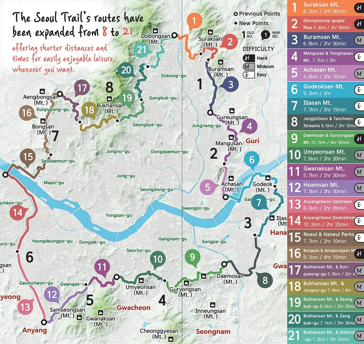
수락산 코스 Suraksan Mt. Course

6.3 km 2h 50min 上級
起点 도봉산역 Dobongsan Stn (Lines 1, 7)
終点 당고개역 Danggogae Stn (Line 4)

Begins at Dobongsan Station, climbs Suraksan Mountain to Danggogae Park Fork. Steep but the rocky scenery is rewarding.

ルート・周辺観光地

Dobongsan Stn → Sangdogyo Bridge → Surakgol Valley → Nowongol Valley → Quarry Observatory → Danggogae Park Fork

서울창포원 Seoul Iris Garden

An iris-themed ecological park spanning 52,417 m², divided into 12 themes for ecology, recreation, and rest.

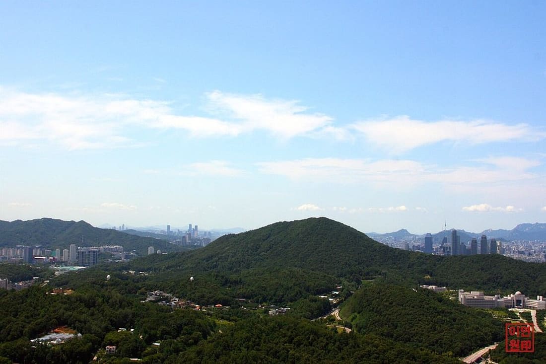
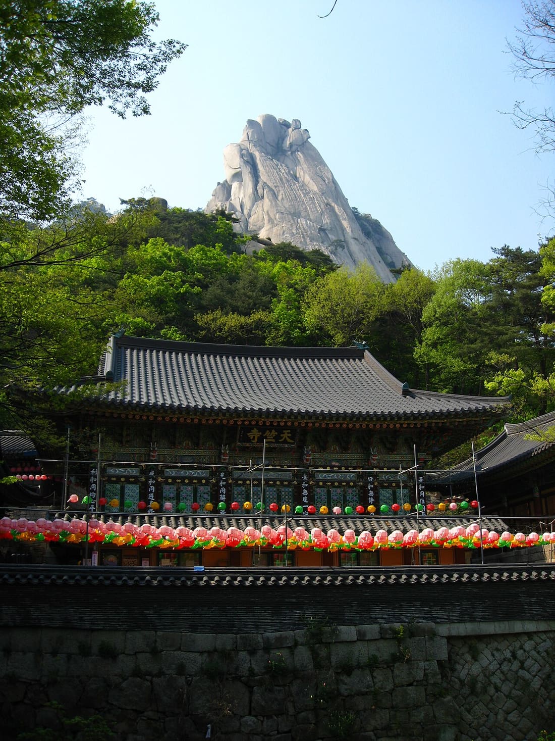
수락산 Suraksan Mt. 638 m
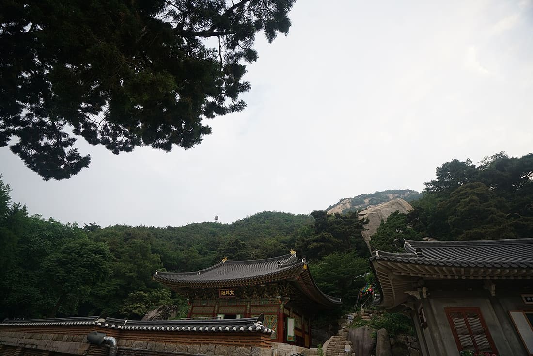
Named for the shape of water drops falling from a huge cliff. Many exposed rocks but climbable.

덕릉고개 코스、ルートマップ
덕릉고개 코스、コース紹介と周辺観光地

덕릉고개 코스 Deongneunggogae Course

5.4 km 2h 50min 上級
起点 당고개역 Danggogae Stn (Line 4)
終点 당고개역 Danggogae Stn (Line 4)

A loop from Danggogae Park Fork through Deongneung-gogae Pass back to Sanggye-dong Royal Azalea Park. Two stamp stations.

ルート・周辺観光地

Danggogae Park Fork → Hangnimsa Fork → Deongneung-gogae Pass → Sanggye-dong Royal Azalea Park

학림사 Hangnimsa Temple

A Jogye Order branch temple founded in 671 by the great Buddhist priest Wonhyo. Monk Hyegeun practiced here during the Goryeo Dynasty.

수락산 자연휴양림 Suraksan Recreational Forest

Korea's first urban recreational forest near Danggogae Stn (Line 4). Gentle slopes, scenic views. Opened 2024.

불암산 코스、ルートマップ
불암산 코스、コース紹介と周辺観光地

불암산 코스 Buramsan Mt. Course

6.9 km 2h 30min 中級
起点 당고개역 Danggogae Stn (Line 4)
終点 화랑대역 Hwarangdae Stn (Line 6)

Starts at Royal Azalea Park, climbs to Buramsan, then descends gradually through Hwarangdae Park to Hwarangdae Station.

ルート・周辺観光地

Sanggye-dong Royal Azalea Park → Buramsan Observatory → Hakdoam Fork → Buramsan Mt → Gongneungsan → Baeksemun Gate → Hwarangdae Stn

Hakdoam Temple
학도암 Hakdoam Temple

In 1624 (2nd year of King Injo, Joseon), the temple was relocated. Famous for a 22.7 m rock-carved seated Avalokitesvara built in 1872.

불암산 Buramsan Mt. 508 m

Named after the large rock on the mountain top that resembles a Buddha (Bul-am = Buddha rock).

망우산·용마산 코스、ルートマップ
망우산·용마산 코스、コース紹介と周辺観光地

망우산·용마산 코스 Mangusan Mt. & Yongmasan Mt. Course

7.7 km 3h 中級
起点 화랑대역 Hwarangdae Stn (Line 6)
終点 사가정역 Sagajeong Stn (Line 7)

A flat route across Mukdongcheon Stream to Joongnang Campground, then climbing to Mangu Cemetery Park via Kkalttakgogae Pass.

ルート・周辺観光地

Hwarangdae Stn → Bonghwasan → Sinnae Eoul Park → Joongnang Campground → Mangu Cemetery Park → Kkalttakgogae Pass Rest Area

망우산 Mangusan Mt. 281.7 m

Spans Mangu-dong and Myeonmok-dong. Burial place of 9 notable figures including writers, scholars, and artists.

망우공원 Mangu Cemetery Park

A history-themed park featuring graves of Han Yong-un, Bang Jeong-hwan (founder of Children's Day), and painter Lee Jung-seob.

중랑캠핑숲 Joongnang Campground

A family-themed campground with picnic areas. Healthy forest, ecological education park for youth and small outdoor activities.

아차산 코스、ルートマップ
아차산 코스、コース紹介と周辺観光地

아차산 코스 Achasan Mt. Course

4.6 km 2h 10min 中級
起点 사가정역 Sagajeong Stn (Line 7)
終点 광나루역 Gwangnaru Stn (Line 5)

Stone steps lead up to Achasan Mountain. Encounter Three Kingdoms-era forts and arrive at Gwangnaru Station.

ルート・周辺観光地

Kkalttakgogae Pass Rest Area → Fork → Achasan Mt → Sunrise Square → Information Center → Gwangnaru Stn

아차산 Achasan Mt. 295.7 m

In the past, Achasan was called Namhaengsan. It bulged towards the south. Locals also call it Akkisan, Aksan, Ekkesan, or Eksan.

Achasan Fort
아차산성 Achasan Fort

Considering excavated relics, the forts on Achasan appear to be remains from the Three Kingdoms period. Likely a Goguryeo fortification.

고덕산 코스、ルートマップ
고덕산 코스、コース紹介と周辺観光地

고덕산 코스 Godeoksan Mt. Course

9.3 km 3h 初級
起点 광나루역 Gwangnaru Stn (Line 5)
終点 고덕역 Godeok Stn (Line 5)

Crosses the Hangang River via Gwangjingyo Bridge and follows Gwangnaru Hangang Park. After Godeoksan, you encounter Amsa-Prehistoric Settlement Site.

ルート・周辺観光地

Gwangnaru Stn → Hanyang Hangang Park → Northern End of Gwangnaru → Amsa Interchange → Archaeological Site → Godeok Stn

고덕산 Godeoksan Mt. 86.3 m

Lee Yang-jung, a loyal supporter of the Goryeo Dynasty, retreated here after the fall of Goryeo. The mountain bears his memory.

Amsa-Prehistoric Settlement Site
암사선사유적지 Amsa-Prehistoric Settlement Site

Neolithic ruins of pit houses dating to 4000–3000 BC. Excavated and restored 1981–1988, then opened as a settlement-site park.

일자산 코스、ルートマップ
일자산 코스、コース紹介と周辺観光地

일자산 코스 Iljasan Mt. Course

7.7 km 3h 15min 初級
起点 고덕역 Godeok Stn (Line 5)
終点 오금교 1 Ogeumgyo Br. 1

Starts at Myeongil Neighborhood Park and follows the ridge of Iljasan Mountain. Passes through Bangi-dong Ecosystem Landscape Conservation Area.

ルート・周辺観光地

Godeok Stn → Flower Market → Sunrise Park → Accessway to Iljasan → Bangi-dong Eco Conservation Area → Ogeumgyo Br. 1

일자산 Iljasan Mt. 134 m

On the eastern outskirts of Seoul. From Baedari in Gambok-dong to Choi-dong, it stretches roughly 5 km north–south. Designated as an Urban Nature Park in 1971.

일자산 둔굴 Iljasan Dungui (Duncho's Cave)

In the late Goryeo period, the scholar Yi Jip fled to a cave at Iljasan, where he lived under the nickname "Duncho" to commemorate his hardships.

장지천·탄천 코스、ルートマップ
장지천·탄천 코스、コース紹介と周辺観光地

장지천·탄천 코스 Jangjicheon & Tancheon Course

8.6 km 2h 35min 初級
起点 오금교 1 Ogeumgyo Br. 1
終点 수서역 Suseo Stn (Line 3)

A flat route along three streams. Seongnaecheon, Jangjicheon, and Tancheon. Passing Songpa-gu and Gangnam wetlands.

ルート・周辺観光地

Ogeumgyo Bridge 1 → Seongnae Stream → Wireseong Bridge → Seongnaegyo Bridges → Jangji Bridge → Tancheon Stream → Suseo Stn

방이동 생태경관보전지역 Bangi-dong Eco Conservation Area

A protected ecological area in Songpa-gu along Wireseong-daero, preserving urban wetland habitat for waterfowl and rare plants.

대모산·구룡산 코스、ルートマップ
대모산·구룡산 코스、コース紹介と周辺観光地

대모산·구룡산 코스 Daemosan Mt. & Guryongsan Mt. Course

10.7 km 4h 50min 上級
起点 수서역 Suseo Stn (Line 3, SRT)
終点 매헌시민의숲 Maeheon Citizen's Forest

Follows the ridges of Daemosan and Guryongsan Mountains. Pleasant walk through dense forest. The longest course in the trail network.

ルート・周辺観光地

Suseo Stn → Bulgukasa Temple → Seoul Trail Info Center → Maeheon Citizen's Forest

대모산 Daemosan Mt. 293 m

Located south of Gaepo-dong and Irwon-dong of Gangnam-gu. Near Heolleung. The royal tombs of King Taejong and Empress Wongyeong.

Guryongsan Mt.
구룡산 Guryongsan Mt. 306 m

Mountain of nine dragons. Legend says a pregnant woman screamed at the sight of 10 dragons ascending to heaven, causing one to fall. Only 9 reached the heavens.

우면산 코스、ルートマップ
우면산 코스、コース紹介と周辺観光地

우면산 코스 Umyeonsan Mt. Course

10.6 km 3h 20min 中級
起点 매헌시민의숲 Maeheon Citizen's Forest
終点 사당역 Sadang Stn (Lines 2, 4)

Circles the Umyeonsan slopes, reaching Daeseongsa Temple at Sadang Station Fork. Easygoing forest walk with cultural stops.

ルート・周辺観光地

Seoul Trail Info Center (Maeheon Citizen's Forest) → Daeseongsa Temple → Sadang Stn Fork

우면산 Umyeonsan Mt. 293 m

Named because the mountain resembles a sleeping cow ("U-myeon" = cow-face). Also called Gwanamsan. Said to look like a huge rock wearing a crown.

대성사 Daeseongsa Temple

Said to have been founded in 384 AD by Maranata, a monk from India. The great Buddhist priest Boyu stayed here in the Joseon Dynasty.

예술의전당 Seoul Arts Center

A festival theater, concert hall, art gallery, museum, and learning center accommodating a wide range of arts activities.

관악산 코스、ルートマップ
관악산 코스、コース紹介と周辺観光地

관악산 코스 Gwanaksan Mt. Course

5.7 km 2h 30min 中級
起点 사당역 Sadang Stn (Lines 2, 4)
終点 관악산공원 Gwanaksan Park (Shillim Line)

Passes Gwaneumsa Temple on the slopes of Gwanaksan Mountain. Continues through Nakseongdae Park, reaching the entrance of Gwanaksan.

ルート・周辺観光地

Sadang Stn Fork → Gwaneumsa Temple → Nakseongdae Park → Gwanaksan Park Entrance

관악산 Gwanaksan Mt. 632.2 m

The summit is composed of rocks. Named because it looks like it is wearing a "gat". A Korean traditional hat. Large rocks and huge peaks form a magnificent view.

낙성대공원 Nakseongdae Park

The holy place where Gang Gam-chan, a Goryeo Dynasty general, was born. Named after a legend that a star fell the day he was born.

호암산 코스、ルートマップ
호암산 코스、コース紹介と周辺観光地

호암산 코스 Hoamsan Mt. Course

7.3 km 3h 30min 中級
起点 관악산공원 Gwanaksan Park (Shillim Line)
終点 석수역 Seoksu Stn (Line 1)

Passes through significant sites such as the Catholic Samseongsan Sanctuary and Hoapsa Temple on Hoamsan Mountain to reach Seoksu Station.

ルート・周辺観光地

Gwanaksan Park → Hoapsa Temple → Seoksu Stn

가톨릭 삼성산 성지 Catholic Samseongsan Shrine

The ruins of a church where three Catholic priests are buried. Martyred during the Gihae Persecution in 1839. Coincidentally, the name Samseongsan also originates from three Buddhist priests who lived here as ascetics in the late Goryeo Dynasty.

안양천 상류 코스、ルートマップ
안양천 상류 코스、コース紹介と周辺観光地

안양천 상류 코스 Anyangcheon Upstream Course

8 km 2h 05min 初級
起点 석수역 Seoksu Stn (Line 1)
終点 구일역 Guil Stn (Line 1)

Open until evening hours. Follows Anyangcheon Stream with several subway stations conveniently located along the way.

ルート・周辺観光地

Seoksu Stn → Geumcheongyo Br → Cheolsango Br → Gwangmyeonggyo Br → Guil Stn

안양천 Anyangcheon Stream

34.8 km long. Originates at Anyangsa Temple in Samseongsan Mountain. The section from Anyang-si to where it meets the Hangang River is designated as a national stream.

안양천 하류 코스、ルートマップ
안양천 하류 코스、コース紹介と周辺観光地

안양천 하류 코스 Anyangcheon Downstream Course

10.2 km 2h 25min 初級
起点 구일역 Guil Stn (Line 1)
終点 가양대교 남단 Gayangdaegyo Br. Southern End

A continuation of the Anyangcheon route. From Guil Station along the Hangang River to Gayang Bridge. Fully accessible.

ルート・周辺観光地

Guil Stn → Ogeumgyo Br → Sinjeonggyo Br → Mokdonggyo Br → Yeomchanggyo Br → Gayangdaegyo Br. Southern End

Seoul Botanic Park
서울식물원 Seoul Botanic Park

Divided into four areas. Forest Field, Lake Garden, Wetland, and Botanic Garden. Tropical and Mediterranean species in a large dome greenhouse. Free entrance to most zones.

노을·하늘공원 코스、ルートマップ
노을·하늘공원 코스、コース紹介と周辺観光地

노을·하늘공원 코스 Noeul-Haneul Park Course

7.7 km 2h 10min 初級
起点 가양대교 남단 Gayangdaegyo Br. Southern End
終点 증산역 Jeungsan Stn (Line 6)

Crosses the Hangang River via the bridge's walkway, then passes through Noeul Park, Haneul Park, and the World Cup Stadium concluding at Jeungsan Stn.

ルート・周辺観光地

Gayangdaegyo Br Southern End → Northern End → World Cup-daegyo Br → Bulgwangcheon Stream → Jeungsan Stn Fork

World Cup Stadium
월드컵경기장 World Cup Stadium

Located in Nanjido-gil, Mapo-gu. Built for the 2002 FIFA World Cup. Capacity of 66,806 people.

월드컵공원 World Cup Park

Five areas: Pyeonghwa Park, Haneul Park, Noeul Park, Nanjicheon Park, and Nanji Hangang Park. Created to commemorate the first World Cup of the 21st century.

봉산·앵봉산 코스、ルートマップ
봉산·앵봉산 코스、コース紹介と周辺観光地

봉산·앵봉산 코스 Bongsan-Aengbongsan Mt. Course

9.1 km 4h 15min 上級
起点 증산역 Jeungsan Stn (Line 6)
終点 구파발역 Gupabal Stn (Line 3)

Starts at the fork near Jeungsan Station. Follows the ridges of Bongsan and Aengbongsan Mountains. Overlaps with Eunpyeong Trail.

ルート・周辺観光地

Jeungsan Stn Fork → Bongsan Sports Park → Bongsan Observatory → Bongsan Mt → Aengbongsan Mt → Gupabal Stn

봉산 / 앵봉산 Bongsan Mt. / Aengbongsan 235.1 m

Bongsan (209m) sits on the border of Gusan-dong, Eunpyeong-gu and Goyang-si. Named for the beacon on the summit. Around 100 tree species including hornbeams flourish here.

봉산 생태경관보전지역 Bongsan Ecological Conservation Area

A 73,478 m² conservation area home to a rare large colony of Sorbus trees. Making this area conservation-significant.

북한산·은평구 코스、ルートマップ
북한산·은평구 코스、コース紹介と周辺観光地

북한산·은평구 코스 Bukhansan Mt. & Eunpyeong-gu Course

5.9 km 2h 45min 中級
起点 구파발역 Gupabal Stn (Line 3)
終点 북한산생태공원 / 불광역 Bukhansan Eco Park (Bulgwang Stn)

Passes through Seollima Temple via Gureunjong-gil. Overlaps with Bukhansan Dulle-gil sections 1 and 2. Easy access from the subway.

ルート・周辺観光地

Gupabal Stn → Seollima Temple → Bukhansan Dulle-gil sec 1-2 → Bukhansan Eco Park

북한산 Bukhansan Mt. 835.6 m

Along with Baekdusan, Jirisan, Geumgangsan, and Myohyangsan, Bukhansan is one of the five great mountains of Korea. Includes the granite peaks Insubong and Mangyeongdae. 14 fortress gates including Daeseomun and Bogungmun still retain their original shape.

다문화박물관 Multiculture Museum

Promotes understanding of cultures from Europe, North America, the Middle East, and Southeast Asia. Hands-on programs for crafts, cooking, food tasting, and traditional dance.

북한산·종로 코스、ルートマップ
북한산·종로 코스、コース紹介と周辺観光地

북한산·종로 코스 Bukhansan Mt. Jongno Course

7.4 km 4h 中級
起点 불광역 Bulgwang Stn (Lines 3, 6)
終点 형제봉 입구 Hyeongjebong Peak Entrance

Extends from Bukhansan Eco Park to the entrance of Hyeongjebong Peak. Overlaps with sections 4–6 of Bukhansan Dulle-gil. Pyeongchanggyeongnae-gil section.

ルート・周辺観光地

Bukhansan Eco Park → Jeonsinsa Temple → Hyeongjebong Peak Entrance

삼성출판박물관 Samseong Museum of Publishing

In Pyeongchang-dong cluster of museums. Showcases Korean publishing history.

김달진미술자료박물관 Kimdaljin Archives Museum

Houses art archives and reference materials in Pyeongchang-dong's museum district.

서울시립미술아카이브 Seoul Museum of Art Archives

Part of the Seoul Museum of Art network. Archives of contemporary Korean art.

북한산·성북구 코스、ルートマップ
북한산·성북구 코스、コース紹介と周辺観光地

북한산·성북구 코스 Bukhansan Mt. Seongbuk-gu Course

6 km 2h 50min 中級
起点 형제봉 입구 Hyeongjebong Peak Entrance
終点 화계사 입구 Hwagye Temple Entrance

From Hyeongjebong Peak entrance to Hwagyesa Temple. Overlaps sections 5 (Myeongsang-gil), 6 (Pyeongchang-gil), and 7 (Solsaem-gil) of Bukhansan Dulle-gil.

ルート・周辺観光地

Hyeongjebong Peak Entrance → Bukhansan Dulle-gil → Hwagye Temple Entrance

북한산 둘레길 Bukhansan Dulle-gil

Connects the ridges of Bukhansan and Dobongsan along a gentle path at the foot of the mountains. Passes through Jongno-gu, Eunpyeong-gu, Seongbuk-gu, Dobong-gu, Gangbuk-gu, and Yangju-si. The trail has 21 sections.

화계사 Hwagyesa Temple

A Joseon-era temple, now offering Templestay programs. Reachable from Suyu Stn (Line 4).

경국사 Gyeongguksa Temple

Templestay-certified temple in Jeongneung. A quiet retreat below Bukhansan ridges.

북한산·강북구 코스、ルートマップ
북한산·강북구 코스、コース紹介と周辺観光地

북한산·강북구 코스 Bukhansan Mt. Gangbuk-gu Course

7.1 km 3h 30min 中級
起点 화계사 입구 Hwagye Temple Entrance
終点 북한산우이역 Bukhansan Ui Stn

Runs from Hwagyesa Temple to Bukhansan Ui Station. Overlaps with sections 7–9 of the Bukhansan Dulle-gil. Includes the April 19th National Cemetery.

ルート・周辺観光地

Hwagyesa Temple → Yeongbongsa Temple → Solbat Park → April 19 Minjumyo → Seoul Gangbuk Youth Center → Jangmiwon Market → Bukhansan Ui Stn

April 19th National Cemetery
4·19 민주묘지 April 19th National Cemetery

Seven columns of the central tower represent the spirit of the April Revolution. 20 funeral codes and guardian statues surround the site. Commemorating the 1960 student uprising that toppled the Rhee regime.

화계사 Hwagyesa Temple

Templestay-certified temple. Overlap with the previous course's ending tour place.

북한산·도봉구 코스、ルートマップ
북한산·도봉구 코스、コース紹介と周辺観光地

북한산·도봉구 코스 Bukhansan Mt. & Dobong-gu Course

7.3 km 3h 25min 初級
起点 북한산우이역 Bukhansan Ui Stn
終点 도봉산역 Dobongsan Stn (Lines 1, 7)

Closes the loop. Overlaps with sections of Bukhansan Dulle-gil and brings the trail back to Dobongsan Stn (Course 1's start).

ルート・周辺観光地

Bukhansan Ui Stn → Royal Cemetery-gil Starting Point → Musugol Village → Dobongsan Info Center → Dobongsan Stn

도봉산 Dobongsan Mt. 740.2 m

On the border of Dobong-gu and the northern parts of Seoul / Uijeongbu-si. Highest peak Jaunbong (740.2 m). Along with Bukhansan, Dobongsan is part of the Bukhansan Mountain network bordered by Uiryeong Pass.

Cheonchuksa Temple
천축사 Cheonchuksa Temple

Templestay-certified temple at the foot of Dobongsan Mountain, founded in the Goryeo era.

実用情報

ベスト

4〜6月と9〜11月初旬が理想。夏は暑く湿度が高く、冬は凍結します。出発前に119で気象警報を確認推奨。

オフライン地図

NAVERマップとカカオマップに全21コースが収録されています。山稜部で電波が切れる前に起点駅をピン留めしておきましょう。

スタンプ帳

ソウルトレイル案内所(水落山・梅軒・峨嵯山・冠岳山)で無料配布。各キオスクで押印すると完歩証明書が発行されます。

初心者向け

13番(安養川上流)または8番(炭川)が最適。平坦な川沿いの道で、時差ボケ初日でもこなせます。

上級者向け

1番(水落山)、9番(大母山・九龍山)、16番(峰山・鶯峰山)。岩場の登りがあるため、しっかりした登山靴を推奨。

緊急時

119に電話。各キオスクに表示された위치번호(位置番号)を伝えると迅速に救助されます。

案内所

コース説明、ルート、ガイドブック地図、案内表示画像は『ソウルトレイル2.0公式ガイドブック』(ソウル特別市・gil.seoul.go.kr)より転載。公共ヌリ第1類型(KOGL Type 1、出典表示)に基づき再配布。補完的な風景写真はWikimedia Commons(CC BY-SA / パブリックドメイン)。

マイ ソウル

in Seoul

AI

AIに聞く

グルメ、観光、ポップアップ、祝日。

見つける
ソウル外へ
プラン
ガイド
もっと

© 2026 Deal Labs. All rights reserved.