Hiking
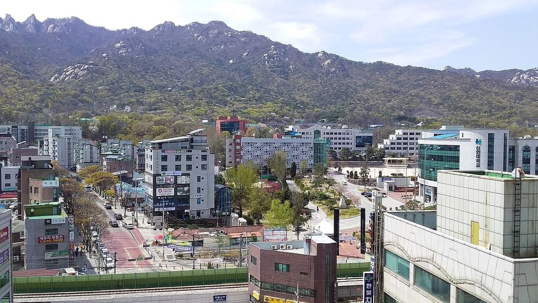
Mountains in the city
Top peaks
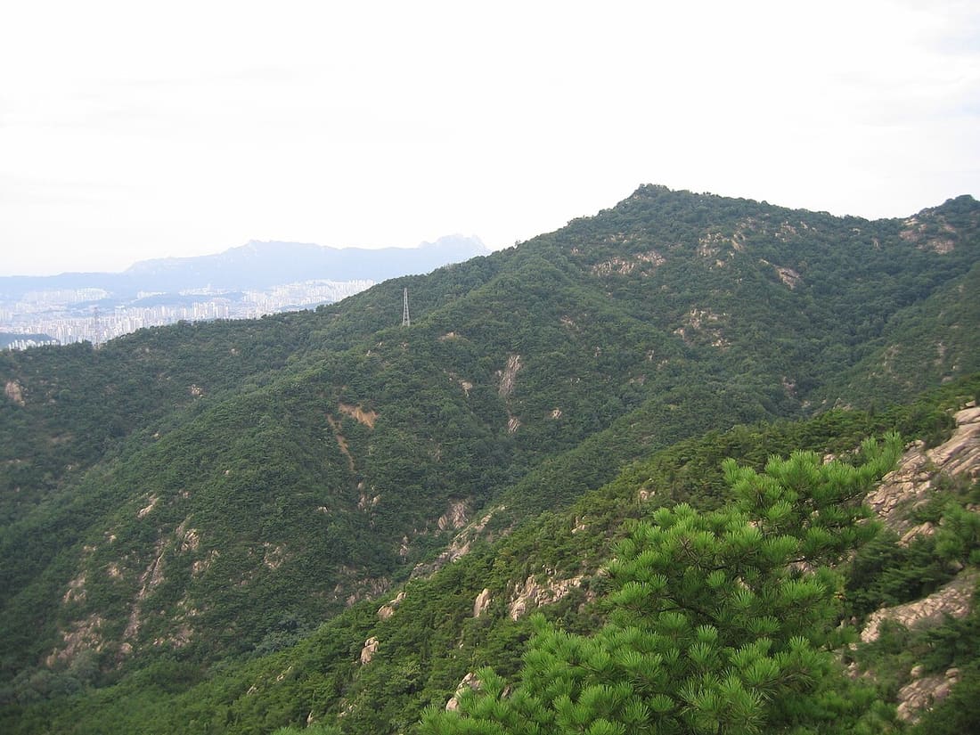
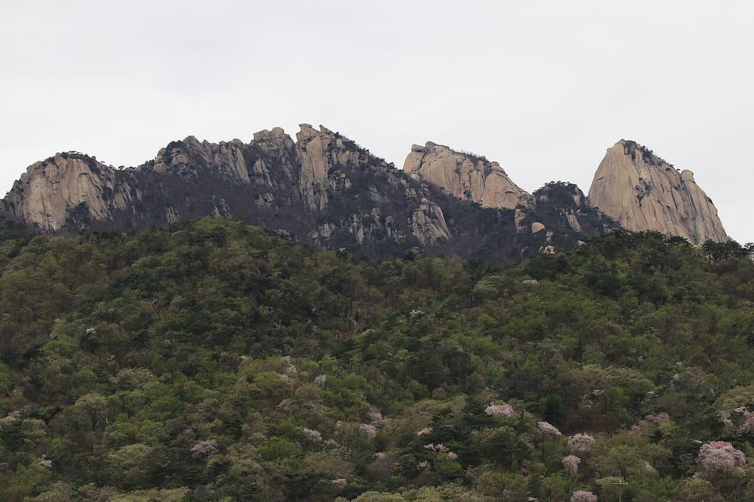 BukhansanEditor's pick 836m · 3h round trip · Moderate
Seoul's most-loved peak inside Korea's only urban national park. Granite spine, sweeping skyline view from the summit, ladders and chains for the last 100 m.
Start before 8 AM to beat heat and crowds. Wear real shoes. The granite is brutal in sneakers.
Gupabal Stn 3Line 3 → Bus 704 to trailhead.
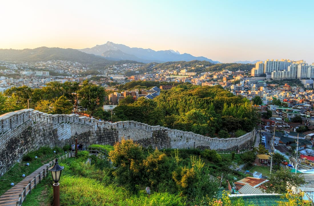
 Inwangsan 338m · 1.5h round trip · Easy-Moderate
Walk the 600-year-old Joseon fortress wall on the ridge directly behind Gyeongbokgung. The summit gives you the entire palace and downtown skyline in one frame.
Check closure days. The trail crosses near the presidential security zone. Bring passport.
Dongnimmun Stn 3Line 3, Exit 2 → 15-min walk to Sajik gate.
 AchasanBest sunrise 287m · 40 min up · Easy
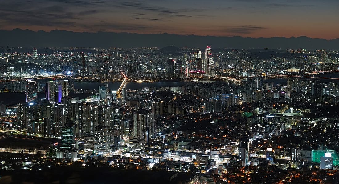
East Seoul. Most-photographed sunrise spot in the city. You watch the Han River turn pink with the city skyline behind. Short, well-signed, no chains.
Sunrise hike: leave the trailhead 70 min before sunrise. Headlamp recommended Oct-Mar.
Achasan Stn 5Line 5, Exit 2 → 10-min walk to trailhead.
Bugaksan 342m · 2h round trip · Easy
North wall of the Seoul fortress, directly behind the palace and presidential office. The Skyway pavilion (Palgakjeong) is one of the best free downtown views, better than N Seoul Tower without the ticket.
Bring passport. ID checked at Sukjeongmun gate. Closed on Mondays.
Gyeongbokgung Stn → 1020 / 7022 bus.
 Naksan 125m · 45 min loop · Easy
East wall of the Seoul fortress. The shortest of the four guardian mountains. A flat, paved walk up to the Naksan Park ridge with full city views. Perfect first hike or sunset stroll.
Pair with the Ihwa Mural Village on the way down.
Hyehwa Stn 4Line 4, Exit 2 → 5-min walk to park.
 Namsan 270m · 50 min up · Easy
The mountain with N Seoul Tower at the top. Multiple trails from Myeongdong or Itaewon, all paved and gentle. Cable car if you don't want to walk.
Walk up, take the cable car down. Saves your knees and maximises the view.
Myeongdong Stn 4Line 4 → Namsan cable car, or Itaewon trailhead via Noksapyeong.
 Suraksan 638m · 4h round trip · Moderate-Hard
Northeast Seoul's big peak. Granite spires, several rope-and-chain sections, and a less-touristed feel than Bukhansan. Subway access right at the trailhead is rare for a real mountain.
Strenuous; experienced hikers only. Sangye route is the standard. Hagye is steeper but shorter.
Danggogae Stn 4Line 4, Exit 1 → 5-min walk to trailhead.
Cheonggyesan 618m · 4h round trip · Moderate
South Seoul's big peak, technically straddles the city limit into Gyeonggi. Forested most of the way, dense maples in autumn, and the iconic Maebong cliff views in the upper section.
Use Indeogwon trailhead for the easier ascent. Avoid early Oct to mid-Nov weekends; trail can hit single-file pace.
Indeogwon Stn 4Line 4Sinbundang → 10-min walk to trailhead.
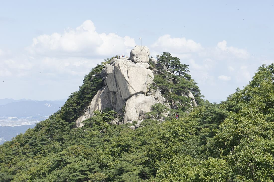
 Dobongsan 740m · 4h round trip · Moderate-Hard
Bukhansan National Park's northern half. Sharper granite, fewer crowds. The Y-junction summit (Y-shaped ridge between Jaunbong, Manjangbong, and Seoninbong) is a Korean climbing classic.
Some upper sections need rope grip; not for first-time hikers. Check trail closures after rain.
Dobongsan Stn 1Line 1Uijeongbu Line, Exit 1 → 10-min walk to trailhead.
Yongmasan 348m · 2h round trip · Easy
East Seoul ridge connecting Achasan to Yongmasan in a single walking line. Sunset on the ridge with the Han River below and downtown skyline catching last light is one of Seoul's underrated views.
Pair with Achasan as a 3-hour ridge traverse. Start at Achasan Stn, end at Yongmasan Stn.
Yongmasan Stn 7Line 7, Exit 2 → 10-min walk to trailhead.
Practical
When to go
April to May (azalea bloom) and October to November (foliage) are world-class. Avoid mid-July through mid-August for the monsoon. December to February is fine for shorter hikes if you have layers; trails get icy on north slopes.
Gear
Real hiking shoes. Granite is slippery in sneakers. 1 L water minimum, light layers, sunscreen. Rent equipment at any of the outdoor shops near Bukhansan. Korea has the world's densest outdoor-gear retail per capita.
Etiquette
Give way to ascenders on narrow paths. No music speakers. 안녕하세요 to fellow hikers. It's a thing. Pack out everything; no rubbish bins on the trail.
Safety
Numbered emergency posts every 200 m on Bukhansan trails. Share the post number with 119 if you're hurt. Cell signal is surprisingly good city-wide. 1330 (24/7 multilingual hotline) also works in the mountains.
Last updated July 2026. Trail conditions and access can change after heavy rain or in winter. Confirm at the trailhead board before going.